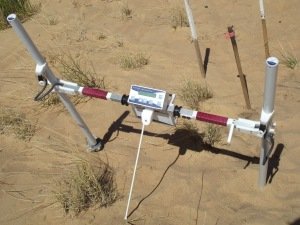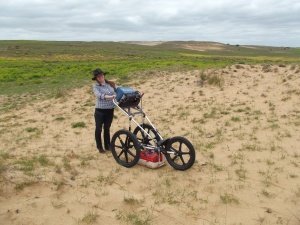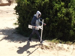
This study though not 100% successful in my opinion, has changed my thoughts in regard to hearth detection methodology. The aim of the study was to detect hearths using two different types of geophysical instrument, one being GPR and the other gradiometer. I theorised that by surveying areas known to contain hearths with two types of instrument would double the chances of success. I also theorised that using the gradiometer first to collect data over the 7 grids would be the most time efficient and successful way to detect potential hearths. After viewing the magnetic data and taking note of where potential hearths appeared in the data, the 7 grids were then surveyed using GPR to confirm the anomalies found in the magnetic data set. Unfortunately, though, there were no hearths detected in the first 7 grids surveyed with the gradiometer, this may have been because there are no hearths in any of the grids (unlikely), the line spacings in the grids were too large, or because none of the survey lines were on the alignment of any subsurface hearths.
When the 7 GPR grids were analysed the three grids at blowout A did appear to contain hearth-like anomalies, some shallow (0.4m) (figure 1) and some deeper (1m) (figure 2). These anomalies were marked on site with wooden pegs after being detected with GPR and readings were taken directly over them using the gradiometer. Readings of -7 to +7 nT were experienced over the anomalies, which corresponds to hearths detected in other studies I researched for the literature review section of this directed study. Therefore, if I was to do this study again in this type of environment I would use GPR first to look for hearth-like anomalies, mark them and then conduct magnetic surveys afterwards, confirming or discounting the anomalies detected in the GPR survey. This study has proven that the use of two geophysical instruments can complement each other, increasing the chances of success. Much more testing is required in different environments in order to develop a strong methodology for the detection of submerged hearths, however. This study has inspired me to develop some test areas (potentially in conjunction with my industry partner) with subsurface artificial archaeological anomalies (i.e. hearths, footings, graves etc) for myself and other students for practice, testing, and calibration of geophysical instruments.
I would like to say a big thank you to: Kelly Wiltshire, Heather Burke, and the NRA for all the information and help they have provided me with, throughout the duration of this study.
Figure 1 (left): is a GPR profile from grid 5, blowout A, a hearth-like anomaly can be seen at approximately 0.4m deep at the 2.4m mark in the profile. Depth is expressed in metres on the left-hand side of the scan and distance is expressed in metres on the top of the scan.
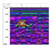
Figure 2 (right): is also a GPR profile from grid 6, blowout A, a hearth-like anomaly can be seen at 1m depth and 6 metres into the scan. Radar worked well in this environment, with the signal propagating to over two metres.