By: Chelsea Colwell-Pasch
Project SAMPHIRE is now in full swing as the team island hops along Scotland’s Western coast and islands aboard DVS Kylebhan (Figure 1). The team travelled from Oban, mainland Scotland, to the Isle of Rasaay in the first five days, conducting archaeological surveys both above and below the water and spanning Mesolithic sites to nineteenth Century shipwrecks.

Figure 1. DVS Kylebhan is a 20 metre (67 feet) trawler converted to a dive charter boat. It can accommodate 12 passengers and is very comfortable for the SAMPHIRE team of six plus the two crew (Photo by: Chelsea Colwell-Pasch)
This year’s Project SAMPHIRE has six potential archaeological sites slated for investigation, however other sites were and are still being located during the course of the field work and added to the Project’s mandate. This blog is a photo journal of the first five days of Project SAMPHIRE’s journey and archaeological investigations.
Day One: Oban to Tobermory (Isle of Mull)

Figure 2. The steam Northwest to Tobermory, Isle of Mull from Oban on mainland Scotland.

Figure 3. Prof. Kurt Lambeck (Australian National University, Canberra) presenting his lecture on glacial rebound in Scotland at the Scottish Association for Marine Science (SAMS) (Photo by: Chelsea Colwell-Pasch).
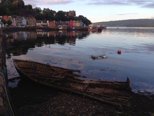 Figure 4. A ‘surprise’ unknown wreck at Tobermory, Isle of Mull, and our docking area for our first night (Photo by: Chelsea Colwell-Pasch).
Day Two: Tobermory (Isle of Mull) to Isle of Eigg, then to Canna

Figure 5. Our travels by sea to Eigg then Canna.
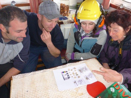
Figure 6. Prof. Karen Hardy from ICREA, Barcelona (far right) showing SAMPHIRE team members Bob MackIntosh (far left), Drew Roberts (middle-left), Chelsea Colwell-Pasch (middle-right) lithics found on her coastal survey of Eigg (Photo by: Jonathan Benjamin).

Figure 7. Galmisdale Harbour on the Isle of Eigg where the first site survey for Project SAMPHIRE was conducted (Photo by: Chelsea Colwell-Pasch).
Day Three: Canna, Loch Bay, Dunvegan and Uig.
Figure 8. The steam North from Canna to Loch Bay, the site of the second wreck, Dunvegan the planned night dock and Uig the actual night docking area.

Figure 9. SAMPHIRE divers Drew Roberts (right) and John McCarthy (left) preparing to dive in Loch Bay on the second project site (Photo by Chelsea Colwell-Pasch).
Figure 10. Chelsea Colwell-Pasch in Uig, Isle of Skye at 22:30 with daylight still visible (Photo by: Jonathan Benjamin).
Day Four: Uig, Loch Bay and Portree, Isle of Skye
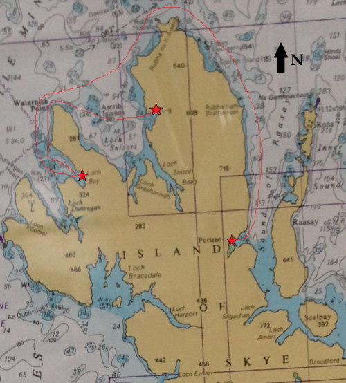
Figure 11. The steam from Uig back to Loch Bay, then the long steam to Portree, our port for the night.
Figure 12. SAMPHIRE diver Bob MackIntosh diving in Loch Bay on the projects second site investigation (Photo by: Jonathan Benjamin).

Figure 13. Dolphins ‘bow-riding’ our vessel Kylebhan on our way to Portree, Isle of Skye (Photo by: Jonathan Benjamin).

Figure 14. At dock in Portree, Isle of Skye after a long steam from Loch Bay (Photo by: Chelsea Colwell-Pasch).
Day Five: Portree, Isle of Sky to Clachan Harbour, Isle of Raasay
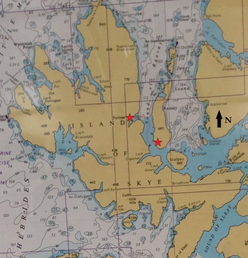
Figure 15. The steam from Portree to Clachan Harbour, Isle of Raasay.
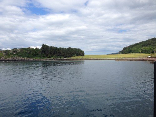
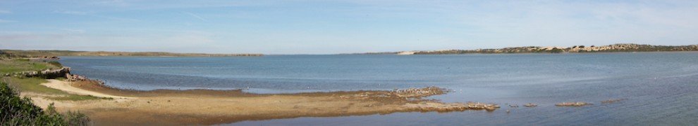
Figure 16. Clachan Harbour on the Isle of Raasay where the SAMPHIRE team was investigating the area for submerged prehistoric sites (Photo by: Chelsea Colwell-Pasch).
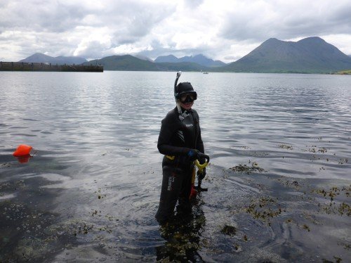
Figure 17. Snorkel survey of Clachan Harbour, Raasay for Mesolithic occupation by SAMPHIRE volunteer Chelsea Colwell-Pasch (Photo by: Jonathan Benjamin).
We are not even halfway through our field work around Scotland’s Western Isles and already Project SAMPHIRE 2014 has been a huge success. Stay informed by following the Project on Twitter (#SAMPHIRE, @WAScotland, @WessexArch, @CColwellPasch) and by checking out the daily posts on the Projects Blog page: http://blogs.wessexarch.co.uk/samphire/