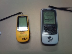
By Wan Jalil (MMA student)
Right after finding a site or an artefact, it should be in archaeologist mind-set to plot its location in any way possible. This could be done in many ways: by jotting it down on a map, putting a marker on it or by visual transit. However, with the advance in technology, plotting could be done by just a simple press of a button. Introducing the GPS device. The Global Positioning System or GPS is a satellite-based navigation system which is basically made up of a network of 24 satellites that orbit the earth around a specific time and route (Bowens 2009: 93). The GPS was originally intended for military uses, but in the 1980s, the United States government made the system accessible for public use.

Flinders University GPS unit


