Tag Archives: Stone artefacts

Controversy and Ethical dilemmas of the rock art discovery at the Coalpac Invincible Colliery, NSW

Map of the area

Image: Map of the area

Since 1989 the company known as Coalpac has been operating in the Lithgow area of the central Blue Mountains, New South Wales. Over that time there have been some environmental issues with the Invincible Colliery. When Coalpac applied for a modification to its mining license to allow for an expansion in 2010, there arose a number of concerns amongst the local community. These concerns were of an environmental nature and the community began lobbying the NSW government to deny the application. Coalpac commissioned an environmental impact statement which satisfied the government requirements by early 2013 and it seemed likely that the application would be accepted (Coalpac 2014b). What happened next is an example of the ethical and professional dilemmas faced by archaeologists employed within the mining industry.

In 2010, Coalpac as part of the environmental impact statement conducted an archaeological survey of the area concerned. The survey was conducted by two archaeology consultants from a mining engineering firm, employed by Coalpac and three representatives of the Wiradjuri people, the local Indigenous community (Coalpac 2012:4-5). In April of 2014 members of the Lithgow Environment Group found a stencil of a handprint in a cave which had not been identified by the Coalpac survey. The presence of the hand stencil was raised with the NSW government as was the validity of the heritage assessment undertaken by Coalpac. The stencil was described as being ‘obvious’ and distinct from the rock face, so how did the survey team miss it? (Hepworth 2014).

Hand Stencil

Image: The hand stencil in question

The original consultants were called in again to have another look and they concluded that the hand stencil motif did not match with other rock art in the area. Furthermore since the rock wall was prone to cracking and flaking due to water flow the stencil could not be of ‘significant’ age. Coalpac declared the motif to be only 3½ years of age at most (drawn since the original survey in 2010) and went as far as declaring it to be a phony (Coalpac 2014a). It should be noted however, that if the stencil was real and the original team missed it the first time, why use them again? Coalpac appeared to acting based on an assumption that the stencil was fake before conducting the second survey. If that was the case was the survey team instructed or encouraged to find that the stencil was modern? Certainly the Australian mining website jumped onto the bandwagon and ran a series of articles immediately following the release of the second survey report, declaring the stencil to be a phony and suggesting that it was simply an attempt by self-serving environmentalists to block a project which would create hundreds of jobs for the community (Hagemann 2014a).

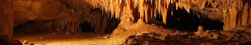
After the second survey the Blue Mountains Conservation Society commissioned an archaeological consulting firm to conduct a third survey of the rock art site. The third survey team found additional hand stencils in other parts of the cave wall as well as scatters of stone tools on the floor. Their conclusion was that the site was used by Indigenous peoples over a long period of time for shelter and that all the rock art in the cave including the ‘phony’ stencil were of considerable age (Blucher 2014). These results were subsequently verified by a representative of the Office of Environment and Heritage which has the final say on matters of Indigenous heritage. So how is it that the results of surveys both conducted by trained archaeologists could differ so radically?

Stone Tools

Image: Stone tools found on the cave floor in situ.

The environmental group opposing the expansion called into question the due diligence and competence of the original survey team. Furthermore perhaps their status as being ‘independent’ consultants should be questioned as well? In addition a representative of the Wiradjuri council claimed that the representatives involved in the original survey were not from the area of the mine and were not familiar with the Indigenous sites located there (Hagemann 2014b). If Coalpac had been serious about protecting Indigenous heritage and following due process surely they should have taken the time to consult with Indigenous people with proper levels of knowledge of the area?

So why did this happen? The answer perhaps lies in Coalpac’s financial situation, the company is currently insolvent and the two open cut mines including the Invincible Colliery are currently not in operation. Energy Australia has declared its willingness to buy Coalpac and re-open the open cuts if the expansion plan is greenlighted. It is entirely possible that Coalpac may have put the archaeological consultants they hired under pressure to produce results that would not cause problems for the expansion plans. Or they may have restricted their time and funding to such an extent that the consultants did not have the resources to conduct more than a preliminary survey of the hand stencil. If that was the case how was it possible that the NSW government was ready to approve the expansion plan, should they have not realized that the heritage assessment was lacking? The author will leave the reader to form their own opinion on the issues raised in this blog but it does highlight the ethical and professional dilemmas faced by archaeologists employed by the mining industry.

Reference List

Blucher, A. 2014 Mine’s Aboriginal ‘rock art’ found to be authentic. Retrieved 27 August 2014 from Mine’s Aboriginal ‘rock art’ found to be authentic – ABC Rural (Australian Broadcasting Corporation)

Coalpac 2014a Community Newsletter July 2014. Lithgow: CW Print on behalf of Coalpac Pty Ltd.

Coalpac 2014b Company Website. Retrieved 26 August 2014 from http://cetresources.com/

Coalpac 2012 Environmental Impact Statement. Retrieved 26 August 2014 from https://majorprojects.affinitylive.com/public/637aed249f70dea6ec7b53b2235ef77e/10.%20Coalpac%20Consolidation%20Project%20EA%20-%20Main%20Report.pdf

Hagemann, B. 2014a “Aboriginal” art stopping coal expansion found to be phony. Retrieved 27 August 2014 from “Aboriginal” art stopping coal expansion found to be phony | Mining Australia

Hagemann, B. 2014b Coalpac’s claims about age of Aboriginal hand stencil in dispute. Retrieved 27 August 2014 from http://www.miningaustralia.com.au/news/coalpac-s-claims-about-age-of-ben-bullen-hand-sten

Hepworth, A. 2014 Mine’s ‘rock art’ just 3½ years old. Retrieved 1 September from http://www.theaustralian.com.au/business/mining-energy/mines-rock-art-just-3-years-old/story-e6frg9df-1226964358502#

What you see is (not always) what you get? A final reflection on the analysis of the stone artefacts from Gledswood Shelter 1

Who would have thought a box of artefacts from a remote shelter in northwest Queensland could contain such a complex story of the past 10,000 years?  Well at least it has proved to be a much more complex story than I could have imagined and I have only managed to scratch the surface as part of my directed study. The project has proven to be more demanding in time and effort than any other subject I have undertaken and still there is so much that seems incomplete and in need of further research. There is more than a thesis waiting in just one square of excavation from Gledswood Shelter 1 (GS1).

Part of my study involved age-depth modelling. This is the process of using the radiocarbon dates obtained from the spits throughout the excavation to understand the history of sedimentation at the site. Age-depth modelling is a science in its own right and what I learned from my study was that GS1 warrants a thorough modelling of its history of sedimentation using some of the modern techniques available, such as linear regression, splines and interpolation. This work alone would be enough for a directed study project.

I also learned that what you think you see is probably not what you can see. My tendency was to see trends in the spits in terms of artefacts numbers and to believe that these trends were real. However, once these numbers were correlated with time in the age depth model a very different picture emerged. What appeared to be a peak in artefact numbers was not, and what did not appear to be a peak in artefact numbers was.

OLYMPUS DIGITAL CAMERA

Evidence of the use of stone axes such as the axe pictured is seen as small basalt fragments throughout the excavation at GS1

Once the trends were understood it was time to make sense of this through researching the available literature. A trend towards increased activity at the site seems to correlate with a wider trend that occurred across northern Australia during the mid to late Holocene, where populations moved into more marginal areas exploiting food sources not previously used, such as the toxic seeds of cycads. These changes were believed to be responses to rapid climatic changes that required innovations in the way people lived off and used the land, and the technologies available to them. There are many more questions to be answered in relation to these responses to change. For example, there are reports that some sites show evidence of responses to change in the mid Holocene, whilst others show evidence later in the Holocene, sometimes a couple of thousands of years apart. The site specific nature of these responses is a complex question and GS1 still has many questions to be explored.

Perhaps this project taught me more about research than it did about GS1. Sometimes, when I thought I saw clear evidence of a pattern, there was a tendency to search for evidence that would support it. However, this had the effect of excluding information that might challenge my hypotheses. When I became aware of this behaviour I could adjust my approach to research and sure enough the result would often be quite different to what I believed I was observing.

This directed study has been a great journey and I have learned more from this topic than any other. Thanks to Lynley Wallis my Industry Partner who has assisted me throughout my project.

An analysis of the stone artefacts from Gledswood Shelter 1 – update 3

After sorting through, describing and categorising 936 artefacts I can definitely say that my skills in identifying and describing artefacts have improved. With more than 800 of the artefacts comprising flakes and broken flakes, each one had to be studied to identify the features that would enable me to determine how it had been made. Most of these flakes were made of quartz and, owing to the intrinsic properties of that raw material, determining the reduction process proved challenging at times.

After identifying the types, artefacts were then categorised by raw material type, counted and weighed.  The total numbers and weight of artefacts from each spit were volumetrically adjusted to account for differences in the amount of sediment removed from each spit. The results are shown in the graphs below. The graphs show total weight of artefacts in grams per kilogram and total count of artefacts per kilogram. Viewing both graphs shows clearly that, when a large artefact substantially affects the weight—such as in Spit 16 which includes a pestle—the artefact count is not affected and we are not misled by the results.

Artefact Numbers
Artefact Weight

The next phase of the project is to interpret the graphs and other recorded data, which will require consideration of several factors. Firstly, sediment deposition in the shelter is not consistent through time, so the spits do not represent equal periods of time. For example, Spits 20 to 16 represent almost 5000 years of time, meaning the bottom 20% of the excavation represents 50% of the time line. What appears in the graphs as a peaks in artefact counts and weights for the lowest two spits may actually be non-existent when the timeframe of deposition is considered relative to the other spits.

Even when volumetrically adjusted, artefact weights for each spit also need to be carefully considered, as it cannot be assumed that a high weight represents a greater level of activity in the shelter. For example, Spit 16 shows the greatest weight of artefacts for all spits; however, one of the artefacts it contains—a pestle—weighs more than 400g. In contrast, Spit 6 includes 130 flakes that only weigh 174g. The pestle may have only been used once, whilst the flakes may have been used multiple times. So in this case a lower weight could represent greater activity at the site on the basis of the artefact types found.

DSC_0011 A stone used for grinding found in Spit 16

Patterns that need to be explained also include changes in time through the raw materials present. In the lower spits (i.e Spits 20 to16) flakes are equally likely to be made of both quartz and quartzite. After this there is a gradual change, with an increase in quartz flakes and a reduction in the number of quartzite flakes. This change reaches a peak in Spit 6, with a ratio of 97:3 of quartz to quartzite flakes. Trying to determine what might have caused people to change their preferred raw material is one of the things I am exploring.

Selection of Quartz Flakes A selection of quartz flakes from Spit 6

Further afield there are different changes seen in the assemblages of other shelters in northwest Queensland that are not seen in Square B0 at GS1. For example, some shelters have shown changes in raw materials used at a specific time, and increases in the use and presence of grinding stones. These changes have not been seen in Square B0.

Once I’ve explored the patterns seen in  Square B0 I’ll then consider this in relation to the results from the excavation of the adjacent squares in GS1, other shelters on the Middle Park Station, and other shelters in the northwest Queensland region. This will help to understand whether the patterns observed are specific to the Square B0 assemblage, the GS1 shelter, the Middle Park Station area or whether they are part of a wider sequence of changes occurring in Queensland and beyond at the time.

An analysis of the stone artefacts from Gledswood Shelter 1

My directed study project is a part of a larger project that Lynley Wallis is conducting in conjunction with the Woolgar Valley Aboriginal Corporation at the Gledswood Shelter 1 in Northwest Queensland. A number of excavations were  carried out at this shelter in 2006 and 2008. The material from the excavation square, identified as square B0, is the basis for my research project. Excavation of square B0 went down to a depth of 100cm before being blocked by a slab of rock that had fallen from the roof of the shelter. Radiocarbon dating carried out at the site indicates that the material from this square starts at about 10,000 years ago at the deepest point and proceeds to the recent past. The excavation proceeded in twenty 5cm spits, with the material from each spit being sieved and bagged. The next stage of the project for this square is where I get involved.

The artefact material now needs to be cleaned, sorted into material types, weighed, measured and photographed and data needs to be recorded onto a spread sheet.

There needs to be a detailed analysis of the artefacts.  This includes a review of literature of lithic assemblages from the Holocene from other sites relevant to the study site. It also includes the production of a detailed report on the results of the study.

My directed study project is still in its early stages, with the current activity centred on the review of literature relevant to the area. I have just picked up my box of artefacts from the shelter, so now the exciting part starts. I have had a quick look through some of the artefacts from several of the spits and can already notice some significant changes with obvious differences in the presence of some artefacts.

My next update will be during the initial phase of sorting and categorising and I will provide some details on what I am finding.

Yappala Field School

Hello everyone!

I have been undertaking a practicum with AARD over the past few weeks. This blog will outine the recent field school run by myself and staff at Hawker SA.

The Heritage Conservation Team from the Aboriginal Affairs and Reconciliation Division Aboriginal Heritage Branch has developed site recording and conservation workshops to provide Aboriginal people with the skills to undertake basic site recording and site conservation projects for themselves. The skills and understanding gained in these workshops enables the participants to be better informed about the operations of the Aboriginal Heritage Act 1988 and the need for good site recording. On site training enables them to record, plan and to conserve sites of significance and to negotiate with greater confidence with other stakeholders.

The workshop at Hawker was run over four days and included indoor and outdoor sessions. The indoor sessions included presentations on the Aboriginal Heritage Act 1988, stone tool identification, rock art recording, how to find a Grid reference, how to use a GPS and how to identify and record a range of different archaeological sites (scarred trees, knapping sites, burials and rock art) (FIGURE 1).

FIGURE ONE: Induction class at Hawker.  Daniel Petraccaro assisting participants Ernestine Coulthard, Christina Coulthard and Karl McKenzie with map reading.

During the outdoor sessions, participants worked in groups and practiced site recording of an archaeological site at Hookina Spring (FIGURE 2 and 3). All participants were encouraged to use the GPS, to draw site mud maps and also filled out an archaeological site card, which included the site contents and site condition. We all then discussed the processes for recording cultural sites and for drafting site conservation management plans.

FIGURE TWO: Daniel Petraccaro with Ernestine Coulthard, Christina Coulthard, Karl McKenzie and Gila McKenzie at Hookina Spring.

FIGURE THREE: Daniel Petraccaro with Veronon Coulthard at Hookina Spring.

In summary, the field at Hawker achieved the aims presented. All the participants learnt how to undertake basic site recording. The perfect weather also made the field school a more enjoyable experience for everyone!

Thanks for reading and stay in tune for my next blog!

By Daniel Petraccaro (Masters in Archaeology student).

A small town with a big archaeology collection

Amanda Atkinson

Lake Cargelligo is a small remote town in the central west of New South Wales. Driving into the town, the welcome sign indicates a population of 1500 but spend a week there and you will soon realize about half that amount of people still live there, many left during the drought years to look for work elsewhere.

Lake Cargelligo in the central west of New South Wales

The Lake Cargelligo & District Historical Society museum boasts far more of interest than your average small town historic museum. Situated in a very large and well-presented shed at the back of the Lake Cargelligo township, a small number of locals take pride in their extensive collection of artefacts from the 19th and 20th centuries. These are interesting enough on their own, but hidden at the back of the museum, in a small glass display cabinet that most people walk past, is the really exciting stuff. Well, exciting for any archaeologist who likes stone tools.

One rainy day back in 2010, a small team of colleagues and I were working on a pipeline project for the local council. We did what any archaeologist would do on a rainy day- we went in search of more archaeology! To our surprise and joy, the local historic museum houses an extensive collection of Indigenous stone tools collected over many years, from the local area. The collection includes everything  from blades, points, grinding implements, flakes to ceremonial stone sculptures, lying uncatalogued in dusty boxes. 

A sample of the artefacts on display at the Lake Cargelligo museum

An off-hand comment made during a meeting in early 2012 about the need to record the collection made me realise that this was something I could do as part of the Flinder’s Cultural Heritage Practium (ARCH 8515). After discussions with the members of the Lake Cargelligo & District Historical Society, we decided that, along with the recording and cataloging of the collection, they needed a new display which shows off this fantastic collection.

My project will focus on a new interpretive display which recognises the needs of both the Historical Society members, the local Aboriginal community and visitors to the museum. There are other interesting challenges associated with the project. Firstly, the new display will still need to fit into its existing display case, which is one of my major challenges. Secondly, I have limited funds to make the new display, which requires ingenuity and a lot of help from the Lake Cargelligo community.

On the June long weekend (the 9th, 10th and 11th June), the museum hosted its annual open weekend, where members of the Historical Society opened the museum to the public and offered special events such as horse demonstrations using a traditional plough, rope making and other traditional activities. However, this year, there was also an opportunity to “Meet the Archaeologists”. Myself and the same group of colleagues who first visited the museum in 2010, were invited back to the museum where this project first started to discuss archaeology with the public.

A working horse display during the Open Day 2012. Using original historic grinding equipment to grind grain.

Koonalda Cave and Archaeology at the South Australian Museum.

By Sam Hedditch- Graduate Diploma of Archaeology student.

This is the third of my four blog posts for the Flinders Cultural Heritage Practicum I am completing at the South Australian Museum stores at Hindmarsh. I am currently left with three weeks of my placement before my hours have been completed and I am a little sad because I am sure I will miss the people and the artefacts I have been lucky enough to work with.

The past few weeks have taken another exciting turn in my placement at the Museum. John Hodges very kindly included me on the work on the Koonalda Cave material from the Alexander Gallus/Richard Wright excavations. We were going through one of Gallus’ trenches to find evidence of organic materials for dating purposes within boxes that related to particular site layers. A range of organic materials (e.g. bone and shell) can now return reliable radiocarbon dates whereas previously dating was largely conducted on charcoal.  We were also able to find stone tools that had ‘cementation’ of sand, dirt and limestone, as this information is part of a development in dating between geochemistry and archaeology.

Figure 1- One of the illustrations of a Flint nodule from the Koonalda Cave. (Courtesy of South Australian Museum)

Researchers at the South Australian Museum hope to submit three small specimens from this collection from various layers in the trench to give some good preliminary dates in order to back a research grant for a more wide-scale dating program.  This whole process was unfamiliar to me and the fact that many grant applications are being submitted illustrated that the best possible proposal must be put forward in order to receive the grant.

We ultimately found a range of interesting items that were suitable for C14 dating. Interestingly, we also found some small bones, possibly from a masked owl (now extinct in the Nullarbor region), that are shaped like a bone point. There was also a flint stone flake that had charcoal, bone and a cementation of limestone as its cortex, that would also be a very useful artefact for the dating program.  There were also some fascinating stone flakes and what John and I thought were small picks and axes used by people in the caves to quarry the stone.

Figure 2- A dumpy level survey map of the Koonalda Cave. There are many different maps that help piece together the site and its separate excavation seasons.(Courtesy of South Australian Museum)

However, the primary goal as stated above was to find these three samples and be able to link them to various site layers in the notes and maps associated with the excavation. Dr Walshe had a number of large scale maps laid out on the work floor which had been compiled throughout the many seasons by museum staff and speleologists working in the excavations.  The maps were useful in correlating all of the artefacts and the context in which they were collected.

Another critical piece of evidence were the notebooks of Gallus that described the material and layers within the trench that we were sorting. Gallus’ method of recording was certainly not the easiest to follow in terms of handwriting and following a logical order re: page numbers and nomenclature etc, so we had some difficulties reconciling all of the data and finding three suitable samples.

Figure 3- A page from Gallus' notebook. This is why it is important to write clear notes! (Courtesy of the South Australian Museum)

After much time and toil, our samples were found and we are in the process of having them dated. It is again a terrific experience for me and a great opportunity to be a part of this research. It demonstrated that, due to the difficulties associated with obtaining permission to dig old sites like caves or dig new ones, there are available and complete research designs that can be implemented on old collections held in museums. Even the notes and the story of the Koonalda Cave could produce its own archaeological narrative with the right interest, care and dedication.

Figure 4- A profile drawn by Gallus of one of the excavation sites. This was vital information to link layer numbers on the artefacts in the boxes to the notes and the profile sketches. (Courtesy South Australian Museum)

Needless to say, museums are not at all boring places and the excitement at the Hindmarsh store is palpable.  Better yet, I have three more weeks to further my own archaeological interests and work and to learn from some really humble, dedicated and inspiring professionals

Til next time!